Proposals
A new country park for all, as well as new and affordable homes
Pigeon is committed to developing proposals for Sladbury’s Lane which align with local ambition and needs for community infrastructure. We won’t fix the plans for the site until we’ve undertaken a detailed review of the feedback received through our Live Mapping feature, to understand what community infrastructure might be provided alongside new and affordable homes.
We won’t be able to include everything that local residents want, and the plans will need to consider local ambition in the balance with site constraints and the views of statutory consultees such as Essex Highways and the education authority.

Key benefits
Proposals are being designed to meet the needs of the local community
The proposals present an opportunity to help deliver much needed housing through a development designed to respect and reflect the rural character and heritage of the local area.
- A new 10-hectare country park (around double the size of Eastcliff Recreation Ground)
- Up to 350 high-quality new homes
- 30% affordable homes
- 5% custom/self-build homes
- New walking and cycling routes
- Habitat corridors and nature areas
- Minimum 10% Biodiversity Net Gain (BNG)
- Low-carbon heat sources and solar PV panels
The site
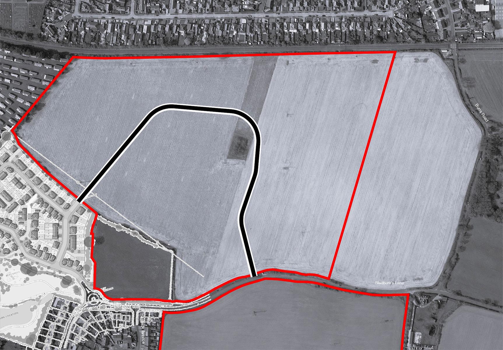
Site location and masterplan
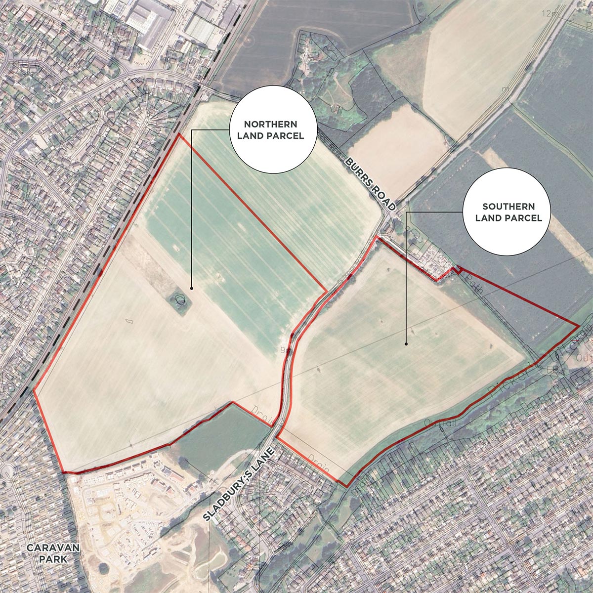
The site is located to the northern and southern side of Sladbury’s Lane, between the eastern urban edge of Clacton-on-Sea and the northern urban edge of Holland-on-Sea.
Clacton-on-Sea has three secondary schools and a number of primary schools, including Holland Park, which is about 1.1km from the Site.
In addition, the town has ample employment opportunities, including Gorse Lane Industrial Estate, 1km to the north, and has numerous local leisure and community facilities.
A Public Right of Way runs through the northern section of the southern parcel.
 Site boundary
 Proposed access
 Residential development
 Primary street with street trees and cycle route
 Secondary street
 Tertiary street
 Edge lane
 Primary road street trees
 Secondary road street trees
 Proposed landscape
 Existing trees
 Sustainable drainage
 Public Right of Way (PRoW)
 Proposed footpath
 Area for play
New homes
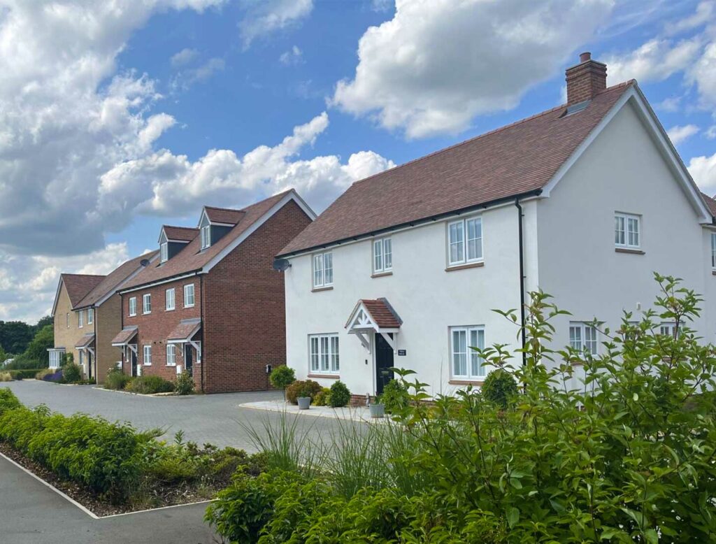
High-quality housing that meets local needs
The proposals will deliver up to 350 high-quality new homes, in a range of housing types sizes and tenures addressing the differing needs of local residents.
The new homes will be designed to complement the local area and create a community with its own distinct sense of place, whilst respecting and preserving the existing character of the surrounding local area. Given that this is an outline application and is to establish the principle of the new homes, further design details will come forward at a later Reserved Matters stage.
As part of the proposals, 30% affordable housing will be provided in varying sizes and tenures including affordable rent, shared ownership, and First Homes, offering a range of options for residents looking to get onto the housing ladder, and helping to reduce the housing waiting list within the district.
As part of the proposals, the new development will deliver a country park that will be accessible to all, designed to foster community activities and recreational opportunities. The landscape proposals will promote a Biodiversity Net Gain of at least 10% by seeking to:
- Retain, protect and enhance the existing vegetation, including ecologically valuable hedgerows and hedgerow trees to provide a mature landscape and help break up the development into smaller discreet units.
- Reinstate historic hedges and tree lines where they were removed post-war and field amalgamated.
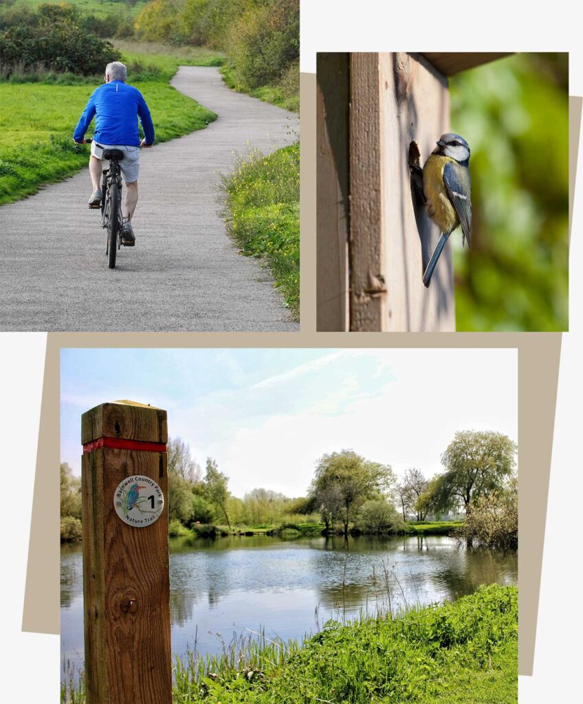
- Create new public open spaces and a country park to support informal recreation and nature engagement, contributing to health and wellbeing.
- Create and enhance a network of Public Rights of Way (PRoW) and footpaths, encouraging active travel and greater community integration.
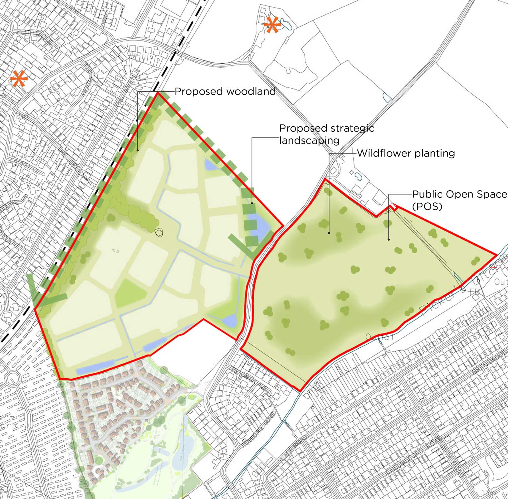
 Proposed woodland
 Wildflower planting
 Proposed green corridor
 Grade II Listed Building
 Proposed SUDs
 Public Open Space (POS)
Site access
Carefully designed access arrangements
The northern parcel of the Site benefits from two good points of access. One access point would be achieved by extending the Maris Otter Lane from the Persona Homes development. The second point of access would be achieved by providing a T-Junction access off Sladbury’s Lane.
Both access points provide pedestrian links to the towns of Clacton-on-Sea and Holland-on-Sea. These will encourage active travel and ensure there is safe provision for all users. The two access points will be linked via an internal road, classified as a ‘Feeder Road’, in accordance with the Essex County Council Development Construction Manual witha 6.75m wide carriageway, a 2.0m wide footway and a 3.5m wide cycleway /footway.
The site is located in a highly sustainable location and benefits from active travel links to both the local centre of Holland-on-Sea and the town centre of Clacton-on-Sea, which incorporates schools, shops, the train station and other community amenities.
New footways and cycleways will be provided within the site, which connect onto the existing links and ensure future residents have easy access to local amenities. Extensions and improvements are proposed to the existing Public Rights of Way routes adding further benefit, increasing access for local residents to the countryside, and providing access to the excellent green spaces proposed within the Site.